Google Earth!
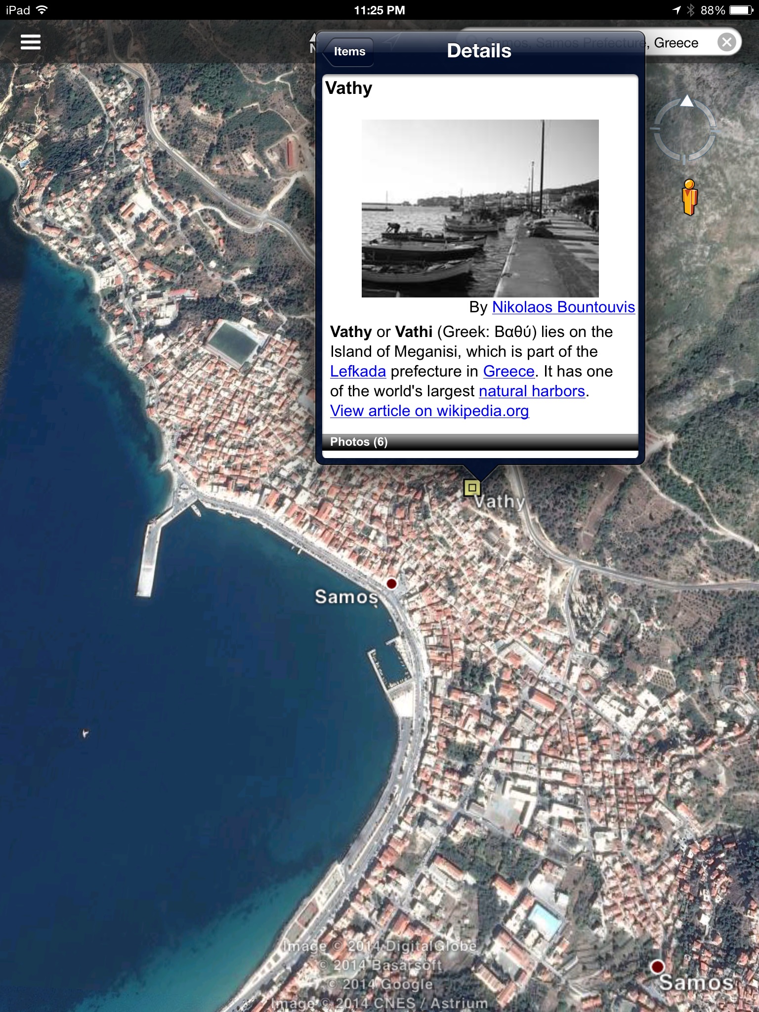
I simply adore this interactive site, and have often been found looking up places here. For a math class, I could have students locate the birthplaces of famous mathematicians as we explore the history of mathematics. For our good friend Pythagoras, we need to locate Samos, Greece. Nearby, there is Vathy, a natural harbor that is near the home of Pythagoras. It doesn’t appear that Google Earth will allow me to put a placemark, and my desktop was not playing nice with Google Earth, but you can see from this screenshot that there has already been a point created at Vathy.
Quizlet!
Vocabulary is something that I struggle with and promise myself that my students need to do more with EVERY year. With Quizlet, I may actually have found a resource for my students to become more familiar with what vocabulary words we will be using in class. I created a short set of flashcards with ratio vocabulary words at http://quizlet.com/45559843/ratio-flashcards-flash-cards/ . I plan to provide a set of flashcards at the beginning of each unit, encouraging students to practice the words with the promise of a quiz on those same words at the end of the unit. In the SAMR model, I think this would be an example of the ‘substitution’ area simply because with a given list of vocabulary words, students will not be creating or analyzing anything, they will simply be defining, explaining, comparing, and so on.
MangaHigh!
Students LOVE games, regardless of what they may or may not be learning along the way. With MangaHigh (https://www.mangahigh.com/en-us/games), students can practice specific math content areas through high interest games. Hovering over each game will give the user an idea of which types of skills will be addressed in the game. This would be a great site for my Math Remediation class. These are the students that already feel as though they aren’t very good at math, and the majority of the hour is spent building their confidence. If students can be successful through a short, interactive game, they may slowly build the positives for math.
ISTE Standards
1 – Facilitate and inspire student learning and creativity – I think that any instructor that can provide the high-quality, interactive resources that were described in this “thing” will have students eager to take part in their own education.
2b Develop technology-enriched learning environments that enable all students to pursue their individual curiosities and become active participants in setting their own educational goals, managing their own learning, and assessing their own progress – The Quizlet site, in particular, will allow students to quickly see how well they know the given vocabulary. They would be able to set individual goals (such as getting at least 80% of the vocabulary words correct) and through the site, the students will be certainly be able to see how well they have achieved these goals.
4b Address the diverse needs of all learners by using learner-centered strategies providing equitable access to appropriate digital tools and resources – With math interactive sites such as Illuminations and IXL, the instructor is able to provide a variety of lessons that are geared towards several different learning styles, meeting those diverse needs of students.
CITW – Best Practices
1 Cues, questions, and advanced organizers – Students can be asked to locate two cities in the United States that they would like to visit. Using Google Earth or Google Maps, the students could calculate distances and develop a budget for a vacation that would include the two places.
2 Assigning homework and practice – The teacher could assign students to practice math vocabulary words through a Quizlet set or through VocabularySpellingCity. This would provide strong and valuable practice for students.
3 Non-linguistic representations – The reality of the images provided by Google Earth will not leave anything to the imagination. Students can look up an actual picture of the Eiffel Tower or the war-torn area of Israel rather than simply trying to visualize the places. The street-view and ground-view features make the places come to life!
